
Hike description
Type
Signposted Loop
Altitude
Max : 1567m
The audience
- Walkers/hikers
Introduction
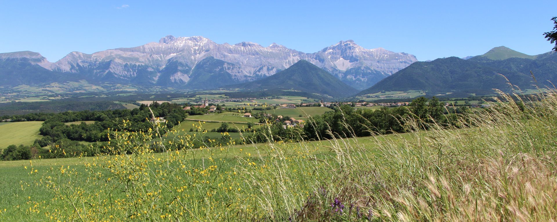
Take a refreshing hike through the magnificent Ménil forest. Once at the top of the mountain, you'll enjoy a panoramic view of the Trièves.
Take the start of a pleasant hike through magnificent forests! This beautiful loop allows you to discover one of the Trièves' emblematic peaks. From the top of its 1,568 meters, you'll find a panoramic view of the Dévoluy peaks and the Vercors cliffs.
Pets welcome : yes
Further information on this Hiking Trail
Yellow line markings (PR)
Tricky passes
Take care on the descent, potentially tricky sections in case of rain.
Map reference
Carte "Promenades et randonnées en Vercors Trièves"
Other information
Adaptez votre équipement en fonction de votre niveau et de la météo. Restez sur les sentiers balisés.
Useful information
Local Services
Access
Step by step
Departure: Park at the "Col de Mens", with roadside parking available. If there's no more space, the hike can start from the center of Tréminis l'Eglise, near the town hall.
1) From the "Col de Mens", look for the signpost indicating Le Ménil at 1h30. Follow this direction up a wide path. Follow the signs, which will take you to the left a little further on. A slight descent takes you through the pine forest, with beautiful views to your left. The path curves upwards again to take you to the "Les Gerlats" signpost.
2) From "Les Gerlats", take the left-hand path towards "Replat de Ménil". This is the recommended route up to the summit. A pleasant path leads through the forest, giving you a gentle ascent to the next signpost "Replat de Ménil".
3) From "Le Replat de Ménil" follow the signs for "Ménil". From this sign, the climb becomes more complex, and a good slope takes you to the "Sous Ménil" sign. Take the path to the right to quickly reach the summit of Ménil after a few hairpin bends. From the summit you can enjoy panoramic views of the surrounding peaks, including the Dévoluy massif and the Vercors cliffs. You can even go as far as the viewpoint overlooking the village of Tréminis.
4) After your break at the summit of Le Ménil, you can start your descent. Follow the path you used on the way up to the "Sous Ménil" signpost. The relatively steep slope calls for a degree of caution. You'll soon reach the "Sous Ménil" signpost, where you follow the path to the right towards "Les Gerlats". The little path takes you up the wild north face of Le Ménil!
5) From the "Les Gerlats" signpost, follow the same path to "Col de Mens" as you did on the way up, to reach your starting point.
Location
Col de Mens
38710 Tréminis
Park at Col de Mens, but be careful as there may not be much space. You can also start from Tréminis l'église, next to the town hall.
Latitude : 44.760241
Longitude : 5.771529
Altitude : 1109m