
Hike description
Type
Signposted Loop
Altitude
Max : 1651m
The audience
- Walkers/hikers
Introduction
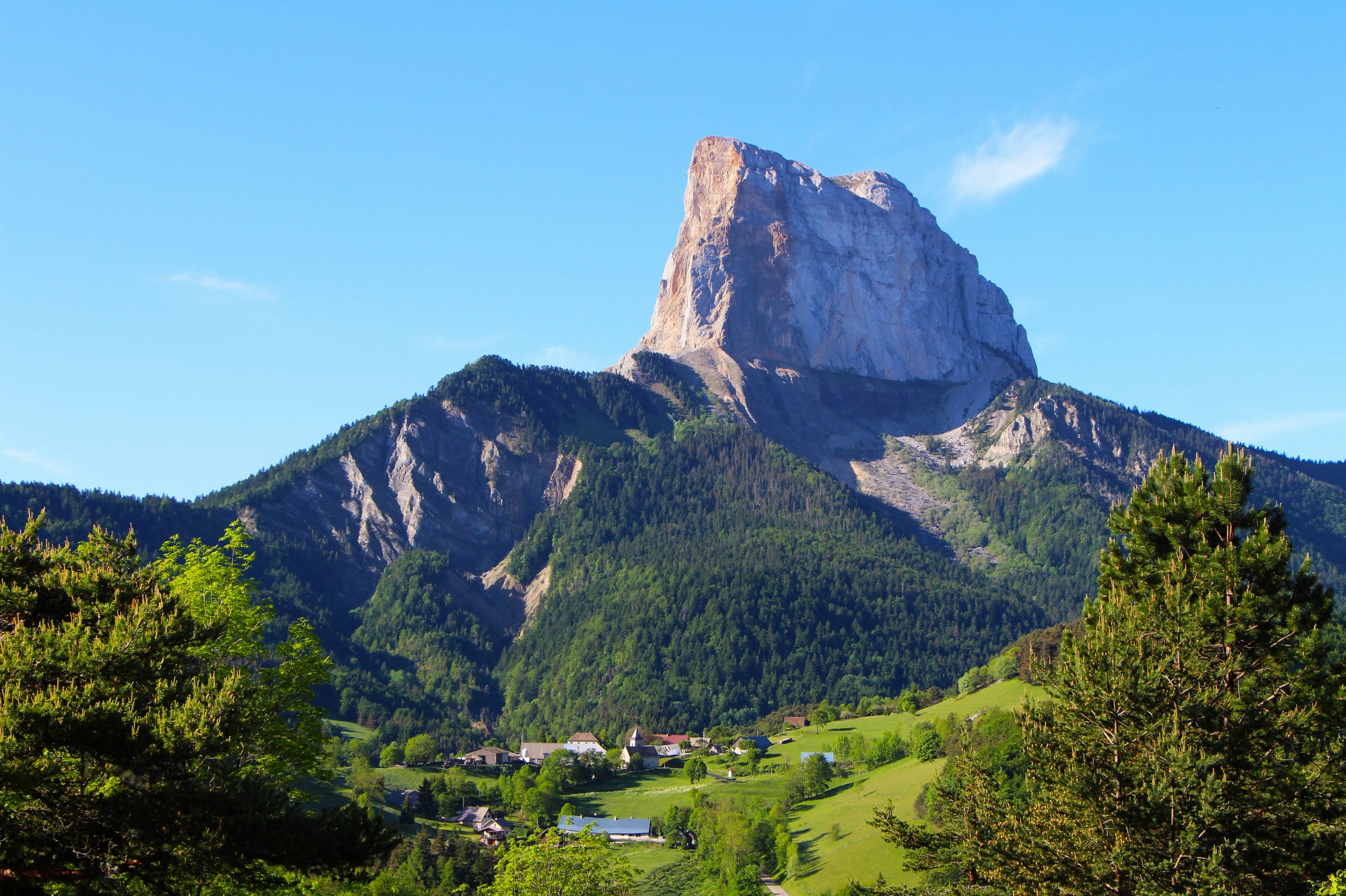
A varied walk alternating between forested and open stretches, the Brisou ridge offers magnificent views of Mont-Aiguille and Grand-Veymont. Two picnic tables make for a pleasant break at the summit!
After the short but athletic ascent through the forest, the reward is incredible: a 360° panoramic view. Look out for the little wooden letterbox almost at the end of the crête du Brisou to leave a note or a drawing in the souvenir book!
Pets welcome : yes
Further detail on accompanying pets : Only possible with a dog on a leash. Please note that during the summer season, sheep and guard dogs are present.
Further information on this Hiking Trail
The markings are yellow-green lines (PR).
Tricky passes
Short section between Serre Girardet and Col de l'Allimas requiring caution (gully with significant erosion). During the summer, ewes with guard dogs are present. Follow the itinerary carefully and behave appropriately in the event of an encounter with the herd (bypassing them, keeping calm, speaking calmly to the dogs, etc.).
Map reference
Carte "Promenades et randonnées en Vercors Trièves"
Other information
Adaptez votre équipement en fonction de votre niveau et de la météo. Restez sur les sentiers balisés.
Useful information
Local Services
Facilities
Access
Step by step
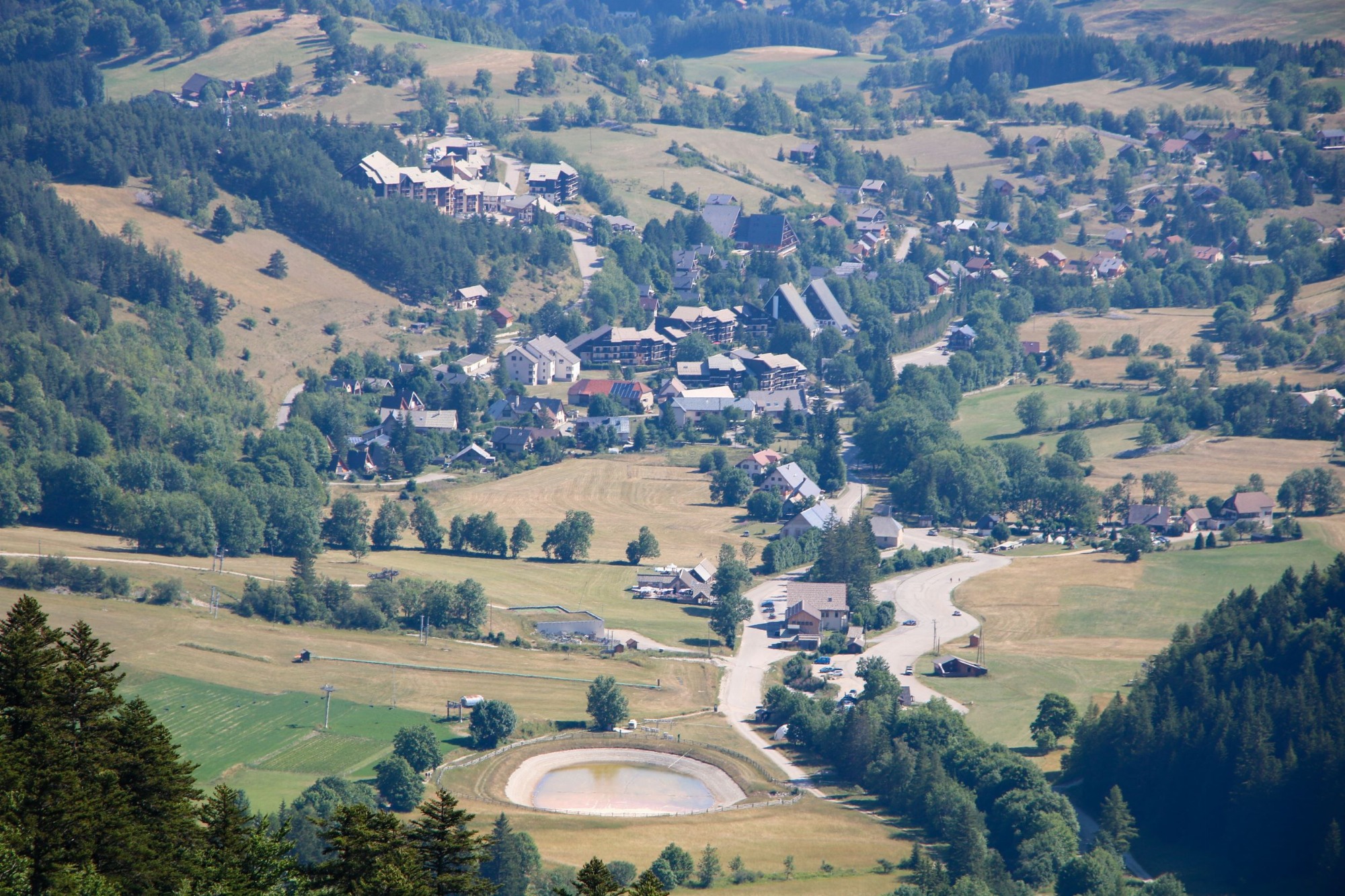
Start: Park at the end of the Gresse en Vercors ski resort parking lot, just after the bridge. A "Champ de l'Herse" hiking post is located near the bridge, on the right bank.
1) Follow the trail for about 100 m to the first signpost, then turn left towards "Crête du Brisou" (the route passes close to the ski jumps).
2) Follow the track, passing under the Blavet ski lift, then continue uphill until you reach a small plateau, where you turn right to reach the top of the Blavet ski lift.
3) The main difficulty of the hike is ahead of you: the ascent through the forest, which then leads to the mountain pasture and follows the ridge to reach the summit of Les Alleyrons (picnic tables) and the "Crête du Brisou" sign.
4) To go back down, follow the signs for "Serre Girardet" along the ridge to the left. After the plateau, the path descends into the forest.
5) Continue downhill, winding through the forest as far as the "Serre Girardet" post, then turn left in the direction of "Col de l'Allimas" (beware of a small, erosion-prone section requiring special attention).
7) From "Col de l'Allimas", follow signs for "Combe Rouge", skirting the road and then taking the track on the left.
8) From "Combe Rouge", turn left onto the small path leading to the Odyssée Verte, direction "Aux Fayolles".
9) From "Aux Fayolles", take the track on the right towards "Côte Emblay" (just beside the Odyssée Verte dry toilets).
10)At "Côte Emblay", continue towards "Girard".
11) All that remains is to return to your starting point, following the signs for "Champ de l'Herse" along the road to the Gresse en Vercors ski resort.
Location
Parking du champ de l'herse (station de ski)
38650 Gresse-en-Vercors
Latitude : 44.891606
Longitude : 5.547527
Altitude : 1236m
A découvrir aussi
A pleasant walk from the village of Gresse en Vercors to the Col de l'Allimas and its magnificent view of Mont-Aiguille: ideal for a family picnic!
Le col de l'Allimas
Gresse-en-Vercors
Start from the resort of Gresse-en-Vercors. This beautiful loop will allow you to discover the source of the famous stream that gave its name to the village, and to observe the Grand Veymont in all its forms.
Les sources de la Gresse
Gresse-en-Vercors